
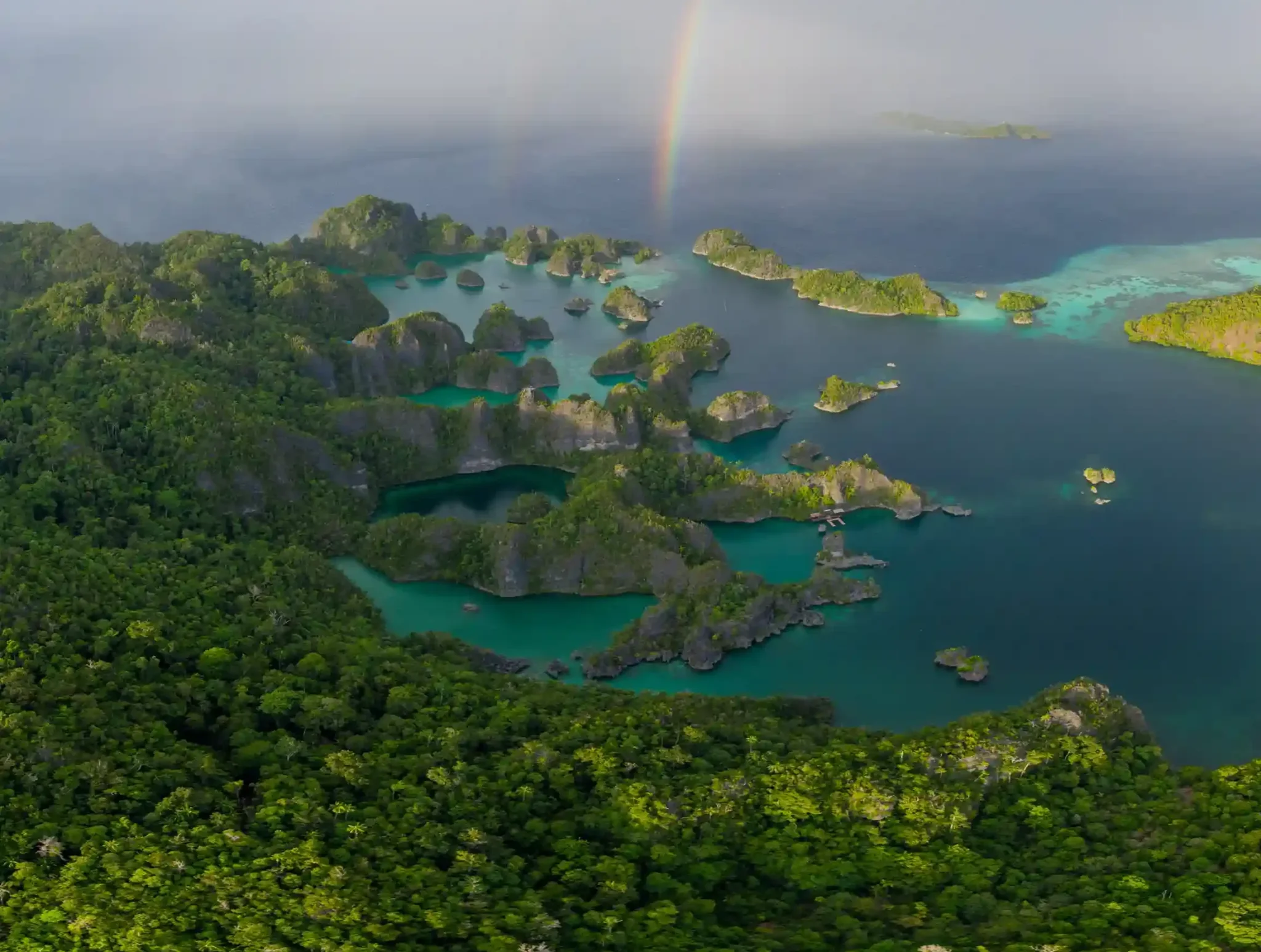
Cenderawasih Bay weather is equatorial and unusually stable: air temperatures hold between 27 and 31°C in every month, sea-surface temperatures sit around 28–31°C, and the bay’s enclosed geography screens out most open-Pacific swell, so workable sea conditions exist year-round. Rain falls in every month as short, heavy bursts rather than in a single defined wet season, and the whale shark aggregation at Kwatisore continues regardless of the calendar. What actually changes month to month is wind direction, shower frequency, inshore visibility after heavy rain, and the window in which liveaboards schedule their departures.
This page is a conditions reference, not a recommendation engine: the raw climate, swell, rainfall and visibility picture for Teluk Cenderawasih, so you can judge your own dates against the data.
What Drives Cenderawasih Bay Weather?
Three forces shape Cenderawasih Bay weather, and understanding them explains almost every entry in the monthly table below.
Equatorial latitude. The bay sits roughly 2–3 degrees south of the equator on the northern coast of West Papua. This close to the equator, seasonal temperature swings barely register, day length is nearly constant, and — critically — tropical cyclones essentially never form or track through the area. The cyclone belts of the Coral Sea and the western North Pacific both lie well away from these latitudes, which removes the single biggest weather risk that affects many other tropical dive regions.
The two monsoons. Like the rest of Indonesia, the region alternates between a northwest monsoon (roughly December through March) and a southeast monsoon (roughly June through September), with lighter, variable transition winds in April–May and October–November. Neither monsoon hits the bay with full force, but each changes which shorelines feel wind chop and where showers concentrate.
Sheltering geography. Teluk Cenderawasih is a deep embayment enclosed by the Bird’s Head Peninsula to the west, the Wandammen Peninsula along its inner arm, and the Papuan mainland wrapping the south and east. Across the bay’s northern mouth, Yapen Island — with Biak and Supiori beyond it — absorbs a large share of any swell arriving from the open Pacific. The result is a huge body of water with very limited fetch in most directions. This is the structural reason the bay supports near-year-round marine operations while more exposed Indonesian regions shut down for parts of the year.
That protected water is also why Teluk Cenderawasih National Park — Indonesia’s largest marine national park at roughly 1.4 million hectares — can be worked in every month: the calm is a feature of the geography, not a seasonal accident.
Cenderawasih Bay Weather and Sea Conditions by Month
The table below compiles indicative conditions as of 2026. Equatorial weather varies year to year, so treat ranges as planning guidance rather than a forecast; monthly rainfall around Nabire typically lands between 150 and 350 mm across the year, with no month reliably dry.
| Month | Prevailing wind | Rainfall pattern | Sea state inside the bay | Notes for divers |
|---|---|---|---|---|
| January | Northwest, light–moderate | Frequent showers, often overnight | Calm; light chop on north-facing outer reefs | Water 29–31°C; bagan sites unaffected |
| February | Northwest, light–moderate | Frequent showers | Calm to slight | Inshore visibility can dip after heavy rain |
| March | Northwest, easing | Showers, gradually less frequent | Calm | Late-monsoon lulls produce glassy mornings |
| April | Transition, light and variable | Moderate, short bursts | Very calm | Among the flattest water of the year |
| May | Transition to southeast | Moderate | Very calm | First liveaboard departures of the season appear |
| June | Southeast, blowing offshore | Moderate, often clearer spells | Calm — wind comes off the land | Core liveaboard scheduling window opens |
| July | Southeast, steady | Moderate | Calm inside the bay | Peak season for visiting boats |
| August | Southeast, steady | Moderate | Calm; minor chop near the bay mouth | Outer-reef visibility often at its best |
| September | Southeast, easing | Moderate | Calm | Liveaboard window continues |
| October | Transition, light and variable | Showers increase slightly | Very calm | Late-season departures; quiet sites |
| November | Transition to northwest | Showers increase | Calm to slight | Most boats reposition; land-based access continues |
| December | Northwest, light–moderate | Frequent showers | Calm; light chop on exposed northern edges | Kwatisore aggregation active as in every month |
Two patterns stand out. First, “rainy” here means a hard 30–90 minute downpour, usually late afternoon or overnight, followed by clearing skies; full washout days are uncommon in any month. Second, the sea-state column barely moves — the sheltering geography at work, and the single most important fact about Cenderawasih Bay weather for trip planning.
Why Does the Bay Stay Calm When Other Regions Get Rough?
During the southeast monsoon, the southern coasts of Indonesia — the Banda Sea rim, south Komodo, and much of the eastern archipelago — take sustained trade-wind swell. Cenderawasih Bay experiences the same monsoon, but from the opposite geometry: the southeast wind arrives over the Papuan mainland, meaning it blows offshore across most of the bay. Offshore wind flattens the sea surface rather than building waves, which is why June through September, rough season elsewhere, is precisely when visiting boats concentrate here.
During the northwest monsoon, the exposure reverses and the bay’s northern approaches see more energy. But this is where Yapen, Biak and Supiori matter: the island chain across the bay’s mouth intercepts Pacific swell before it reaches the inner bay, and the long north–south depth of the gulf dissipates what gets through. Inner-bay anchorages and the Kwatisore coast remain workable; the main effect is light chop on north-facing outer reefs and occasional surface texture on crossings.
The practical consequence: land-based operations out of Nabire run in every month of the year, while liveaboards concentrate their Cenderawasih itineraries in a roughly May-to-October window — a scheduling choice driven by fleet logistics and route economics as much as by conditions, since boats rotate between Indonesian regions across the calendar.
What Dive Visibility Should You Expect Through the Year?
Visibility in the bay is less about season and more about location, because the water column behaves differently at the bagan platforms than on the outer reefs.
- Kwatisore bagan sites: roughly 10–20 m. The whale sharks are here because the water is rich — baitfish, net activity and nutrient load keep visibility moderate rather than gin-clear in all months. This is normal and does not meaningfully change with season; photographers should plan for it rather than wait for it to improve.
- Outer reefs and islands: roughly 15–30 m. The clearest water tends to coincide with the settled southeast-monsoon months, though calm transition periods can match it.
- Inshore and river-mouth areas: variable. After a heavy downpour, runoff can drop nearshore visibility for a day or so, most noticeably in the higher-shower months of December through March. Sites away from river influence recover fastest.
Water temperature needs almost no planning: 28–31°C at the surface with weak or absent thermoclines in the bay. A 3 mm suit or less is standard; many divers wear a skin suit for sun and stinger protection rather than warmth.
How Conditions Shape Your Trip Format
Because the conditions floor is high in every month, the weather question in Cenderawasih is really a format question.
If your dates fall between May and October, both formats are open. Scheduled Cenderawasih Bay liveaboard trips run in this window and pair the Kwatisore whale shark site with outer-reef and island diving that day boats cannot reach. Longer routes reward the calm: a 10-day itinerary can cover the bay’s full spread — wrecks, reefs, and multiple bagan sessions — in the settled seas the southeast monsoon delivers inside the gulf.
If your dates fall between November and April, the aggregation is still active and the inner bay is still calm — but the visiting fleet has largely repositioned. This is when land-based Nabire packages carry the season: flights into Nabire operate year-round via Jakarta or Makassar connections, boat transfers to Kwatisore are short, and you trade the outer-reef range of a liveaboard for schedule freedom and lower weather sensitivity. For travellers whose leave dates are fixed, this is the format that makes the northwest-monsoon months productive rather than a compromise.
Either way, build one buffer day into any itinerary involving domestic Papua flights: regional aviation schedules, not sea conditions, are the least predictable element of a Cenderawasih trip in any month.
Check Conditions for Your Dates
Per 2026, the honest summary of Cenderawasih Bay weather is this: no bad season, one scheduling window, and a set of small monthly differences that matter mainly to photographers and outer-reef planners. The bay’s geography has already solved the problem that dominates trip planning elsewhere in Indonesia.
For the current picture on your specific travel dates — which boats are positioned in the bay, what recent rainfall has done to inshore visibility, and which trip format fits your window — ask our trip desk directly. Part of Juara Holding Group, operating from Bali across Indonesia since 2015, we plan Cenderawasih itineraries against real conditions, not brochure averages. Message us on WhatsApp at +62 811-3941-4563 or email [email protected] with your dates.