
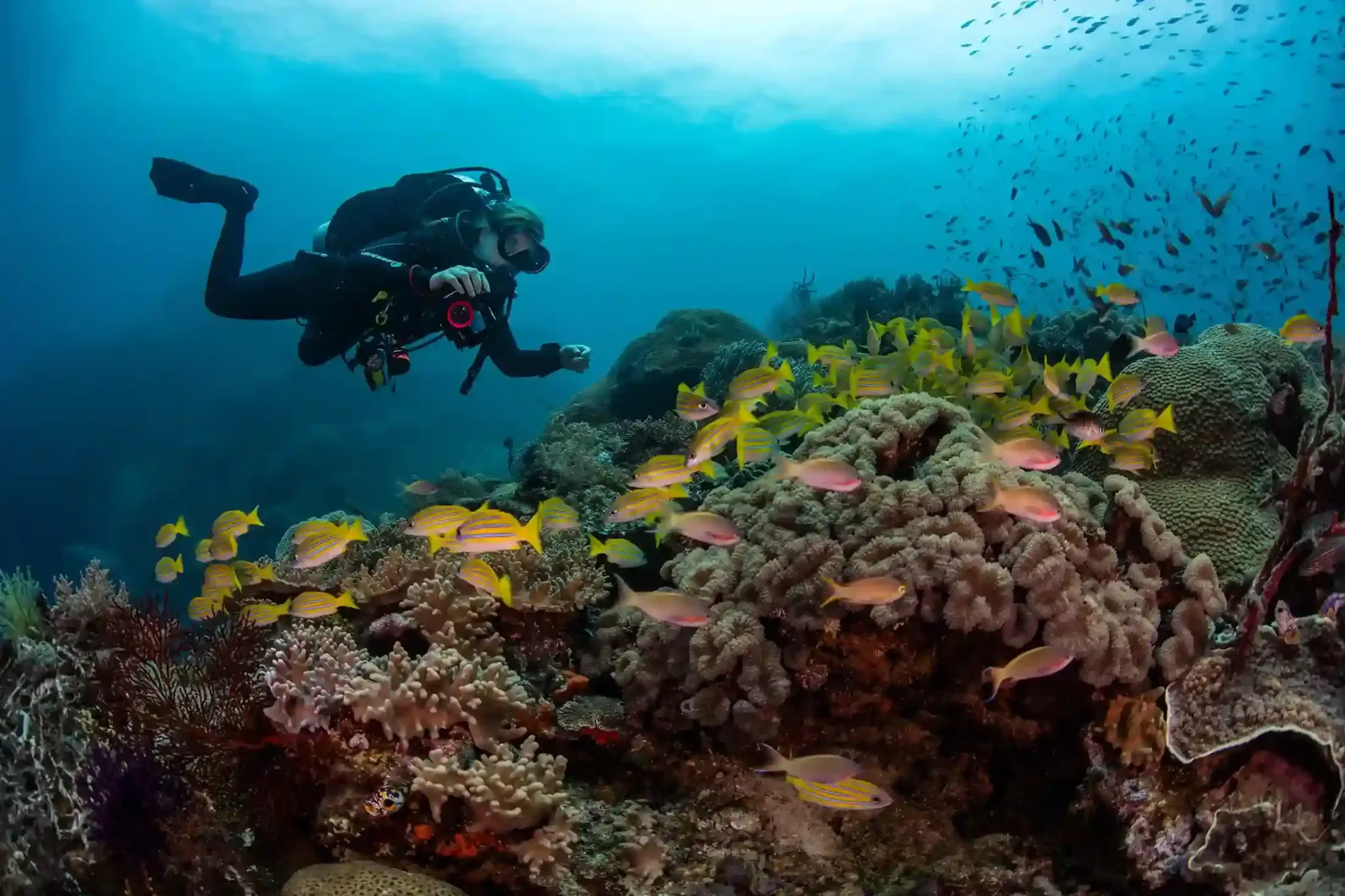
Cenderawasih Bay dive sites fall into five distinct zones: the whale shark bagans of Kwatisore in the south, the reef islands around Purup, the caverns and current points of Tanjung Mangguar, the sloping endemic-rich reefs of Numamuran, and the WWII wrecks of Manokwari in the north. Most sites sit between 5 and 30 metres with mild current, which makes the bay unusually forgiving for a frontier destination — only the exposed points and the deeper wreck sections demand advanced certification. This guide maps every named zone with an indicative depth, current and level table, so you can match your certification and interests to the right route before you commit to an itinerary.
One orientation note first: Teluk Cenderawasih is Indonesia’s largest marine national park, covering roughly 1.45 million hectares of Papuan water between the Bird’s Head Peninsula and the Wandammen coast. Distances here are serious. You do not “day trip” between zones — you choose a base (Kwatisore via Nabire, or Manokwari in the north) or you cover several zones on a liveaboard. That single decision shapes which of the sites below you will actually see.
What Are the Main Cenderawasih Bay Dive Sites?
As of 2026, the sites that operators consistently name and brief fall into the five zones below. The bay has no crowded “circuit” the way better-known Indonesian destinations do; several of these sites may see no divers at all for weeks at a stretch, and briefings on the day always override any published numbers.
Kwatisore and the Bagans
Kwatisore, on the southern shore near Nabire, is the reason most divers come. Local fishermen operate bagans — floating lift-net platforms — and whale sharks aggregate beneath them to feed on baitfish, an interaction documented here almost year-round rather than in a short season. The diving itself is simple: you slip in beside the platform and hold position in the top 5 to 18 metres while the sharks circle. There is little to no current, visibility is variable rather than spectacular, and the skill required is buoyancy discipline, not depth. Snorkellers and freedivers join the same sessions. Around the bagan anchorage, the Kwatisore coast also holds gentle sloping house reefs in the 5 to 25 metre range that work well for check dives and afternoon second dives.
Purup and the Auri Island Reefs
North of Kwatisore, the small islands around Purup carry the classic reef diving of the inner bay: hard coral gardens on the shallow flats giving way to slopes and short walls. Typical profiles run 5 to 30 metres, current is usually mild to moderate, and Open Water divers with a little experience handle these sites comfortably. This is also where the bay’s strangeness shows. Cenderawasih spent long geological periods partially cut off from the open Pacific, and that isolation produced endemic species — including its own fairy wrasse and a walking epaulette shark — that you will not see anywhere else in Indonesia. Divers who work the reef slowly are rewarded far more than those hunting big animals here.
Tanjung Mangguar
Tanjung Mangguar, the prominent cape on the bay’s eastern reach, is the most demanding of the reef zones. The headland concentrates whatever water movement the bay has, so the points can switch from still to running within a single tide. The terrain is the draw: cavern openings, swim-throughs and coral-covered rock architecture in the 10 to 30 metre band, with fish action noticeably denser than on the sheltered inner reefs whenever current is present. Operators treat the exposed corners as advanced sites and the sheltered sides as intermediate — accept their call on the day.
Numamuran
Numamuran’s sloping reefs are the connoisseur’s stop: less dramatic topography than Mangguar, but consistent coral cover and the best odds of ticking off the bay’s endemics in one relaxed dive. Depths of 8 to 28 metres and generally mild current put it within reach of most certified divers, and photographers often rate it the most productive macro zone in the bay. Our existing macro and beginner-reef write-ups both draw heavily on this stretch of coast.
The Manokwari Wrecks
At the bay’s northern gateway, Manokwari’s Doreri Bay holds documented Japanese WWII wrecks that give Cenderawasih a second identity entirely. The Cross Wreck — named for the shoreline memorial cross nearby — lies in roughly 15 to 20 metres and is manageable for any comfortable Open Water diver. The larger Shinwa Maru off Pasir Putih beach runs from about 16 metres at its shallowest point down past 30 metres, so its deeper holds are advanced territory. Both wrecks are heavily encrusted after eight decades underwater and carry resident fish life dense enough that they work as reef dives even for divers with no wreck interest. Because Manokwari has scheduled flights, these sites are also the easiest in the bay to reach on a short land-based trip.
Depth, Current and Level: The Master Table
The table below consolidates the Cenderawasih Bay dive sites into one reference. Figures are indicative, compiled from operator briefings as of 2026 — conditions in a park this size vary by tide and season, and your guide’s on-site call is final.
| Site / Zone | Area | Typical depth | Current | Level |
|---|---|---|---|---|
| Kwatisore bagans (whale shark) | South, near Nabire | 5–18 m | None to slight | All levels + snorkellers |
| Kwatisore house reefs | South, near Nabire | 5–25 m | Slight | Open Water |
| Purup island reefs | Inner bay, Auri group | 5–30 m | Mild–moderate | Open Water+ |
| Tanjung Mangguar points | Eastern cape | 10–30 m | Moderate–strong on tides | Advanced |
| Tanjung Mangguar caverns (sheltered side) | Eastern cape | 10–25 m | Mild | Intermediate |
| Numamuran slopes | Eastern coast | 8–28 m | Mild | Open Water+ |
| Cross Wreck | Manokwari, Doreri Bay | 15–20 m | Slight | Open Water |
| Shinwa Maru (Pasir Putih) | Manokwari, Doreri Bay | 16–30+ m | Slight–mild | Advanced for deep sections |
How Do You Actually Reach These Sites?
There are only two practical gateways, and each unlocks a different half of the map. Nabire, reached by domestic connection through Makassar or Jayapura, is the base for Kwatisore: the bagans sit around three hours by boat from town, so land-based divers sleep in Nabire or at simple coastal accommodation and run out daily. Manokwari, with its own scheduled flights, puts the Doreri Bay wrecks within minutes of shore and suits divers who want WWII history without an expedition budget. The middle of the map — Purup, Mangguar, Numamuran — realistically belongs to boats. A small liveaboard fleet schedules Cenderawasih departures in seasonal blocks rather than year-round, which is why itineraries here get booked further ahead than the bay’s obscurity would suggest; our Cenderawasih Bay liveaboard trips desk tracks which vessels are actually positioned in the bay for a given month.
Which Sites Match Your Certification?
- Snorkellers and new Open Water divers: the Kwatisore bagans and house reefs, the Cross Wreck, and Numamuran on calm days. This is one of very few frontier destinations where a beginner can meet the headline animal on day one.
- Open Water with 20+ dives: add the Purup reefs and the sheltered Mangguar caverns. A structured Cenderawasih Bay dive trip in this bracket typically combines Kwatisore with two reef zones.
- Advanced divers: the full map — Mangguar’s points on a running tide and the Shinwa Maru’s deeper holds are the bay’s two genuinely demanding dives, and both justify the certification card.
- Photographers and pattern-seekers: plan around a multi-zone route; a Cenderawasih Bay dive safari that strings Kwatisore, Numamuran and Manokwari together covers wide-angle, endemic macro and wreck work in one trip.
When Should You Dive Cenderawasih Bay?
The whale shark aggregation at Kwatisore is documented across most of the year — a genuine anomaly among the world’s whale shark sites, and the reason the bay rewards off-peak travel. The practical constraint is not the animals but the boats: because the liveaboard fleet enters the bay in seasonal windows, reef zones beyond day-boat range are effectively “open” only when vessels are positioned there. If your priority is the full site list rather than the bagans alone, plan around vessel schedules first and dates second. Sea conditions inside the bay are generally calmer than the open Pacific coast, which keeps most crossings comfortable outside of localized weather.
Plan Your Route Through the Bay
Reading about Cenderawasih Bay dive sites is the easy part; sequencing them into a trip that matches your certification, dates and budget is where a desk that works this destination weekly earns its keep. Tell us your experience level and window, and we will map which zones are reachable, which vessels or land bases fit, and what an honest itinerary looks like — with indicative costs confirmed before you commit, never after. Part of Juara Holding Group — operating from Bali across Indonesia since 2015 — our team coordinates Cenderawasih routes end to end, from Nabire logistics to liveaboard berths. Message us on WhatsApp at +62 811-3941-4563 or email [email protected], and start with the sites you most want to see.